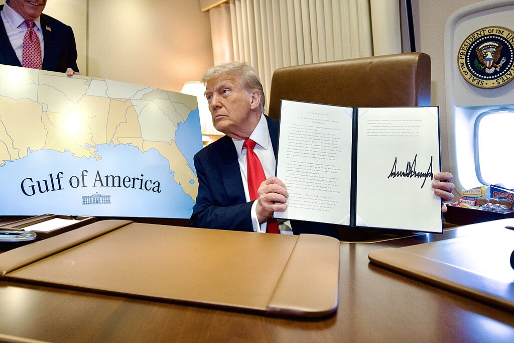
On January 20, 2025, U.S. President Donald Trump issued Executive Order 14172, “Restoring Names That Honor American Greatness”, which mandated inter alia the renaming of the U.S. continental shelf area of the Gulf of Mexico to the “Gulf of America”. The Executive Order is binding for the U.S. federal administration’s executive branch and the name change is to be reflected in all U.S. “federal references to the Gulf of America, including on agency maps, contracts, and other documents and communications”; it has already been implemented by the Secretary of the Interior and the U.S. Board on Geographic Names (as outlined in 43 U.S. Code § 364) and reflected in the official U.S. Geographic Names Information System. Additionally, on May 8, 2025, the U.S. House of Representatives passed the “Gulf of America Act” of 2025, which aims to codify the name change. As of July 2025, the bill has yet to pass the Senate. While the change is mandatory only within the U.S., it has produced ripple effects across mapping platforms and raised questions regarding its consistency with international regulations on geographic nomenclature and standardization. This post examines the relevant regulatory framework and situates President Trump’s order within the broader practice of unilateral geographic renaming.
First Litigation: Mexico v. Google
The name change has also already been implemented by the U.S. technology company Google LLC. Through its applications Google Maps and Google Earth, the company now displays “Gulf of America” for U.S. users, “Gulf of Mexico” for users in Mexico, and “Gulf of Mexico (Gulf of America)” for users elsewhere.
Mexican President Claudia Sheinbaum has consistently argued that the U.S. had the authority to rename only the U.S. continental shelf portion – as stated in the Executive Order – and not the entire Gulf, as currently shown on U.S. federal maps and Google Maps. She has held that renaming the portion under the jurisdiction of Mexico (as well as the one of Cuba) constitutes a violation of its sovereignty, invoking also the 12-mile territorial sea zone according to the UNCLOS (that the U.S. is not a state party to), and considered already in February 2025 legal action against Google due to the global outreach of its mapping service. The following month, La Jornada reported that a civil lawsuit for damages against the Mexican branch of Google Operaciones de México S. de R.L. de C.V. had been dismissed on 6 March 2025 by the Tenth District Civil Court in Mexico City due to lack of jurisdiction. Judge Eduardo León Sandoval argued that the nomenclature change “does not result in a detriment to the nation’s assets, such as the continental territory, insular territory, territorial sea, and/or exclusive economic zone, since it is merely a unilateral variant of information that does not deprive the state of its assets” and therefore does not violate international law.
Following a series of fruitless exchanges between the Mexican government and Google, El País reported on 9 May 2025 that in a subsequent lawsuit filed with the Superior Court of Justice of Mexico City (Tribunal Superior de Justicia de Ciudad de México) an interim decision, subject to appeal, has been issued, ordering Google to “immediately correct on its platforms the name of the Gulf of Mexico”. This lawsuit is still pending by early August 2025.
How Is International Cartographic Standardization Regulated?
Absent an agreement on a single common name between states that share a geographical feature, international cartographic guidelines recommend the parallel use of each state’s preferred nomenclature, the so-called concurrent use principle.
A well-known example of accepted concurrent use is the English Channel or La Manche – the two names used for the body of water separating Great Britain and France. Other established examples of concurrent use include Maxwell Bay in Antarctica (also called Bahía Filde in Chile and Bahía Guardia Nacional in Argentina); the Bay of Biscay (Golfo de Vizcaya in Spain, Golfe de Gascogne in France), the Baltic Sea (East Sea in the respective languages of Denmark, Finland, Germany, Iceland, the Netherlands, Norway, and Sweden; West Sea in Estonia), the Matterhorn / Cervino mountain on the Swiss-Italian border, or the South China Sea (南海 Nán Hǎi ‘South Sea’ in China, Biển Đông ‘East Sea’ in Vietnam). There is also a precedent for concurrent naming between the U.S. and Mexico, where the river forming part of their shared border is referred to as the Rio Grande or Rio Bravo, respectively. This dual naming was consistently adopted in a 1944 bilateral treaty between the two states (Treaty on the Utilization of the Waters of the Colorado and Tijuana Rivers and of the Rio Grande of 3 February 1944).
Apart from such bilateral solutions, the general international law sources of the concurrent use principle are found in two soft law instruments from the 1970s. One of them is the International Hydrographic Organization’s Technical Resolution “International Standardization of Geographical Names” (IHO Resolution 1/1972, IHO A 4.2). This resolution encourages states to reach an agreement on a single name for their shared maritime features and, failing that, recommends acceptance of each state’s name in official charts – unless technical limitations prevent this on small-scale charts (para. 6). The IHO, an intergovernmental organization founded in 1921 and with currently over 100 member states, is the UN-recognized authority on nautical charting. However, its publication on names and borders titled “Limits of Oceans and Seas” (IHO S-23), in its currently accepted form, dates back to 1953 and does not reflect more recent developments. A subsequent updated version has remained in draft form due to disagreements between certain member states, and currently appears to be suspended in favour of work on the creation of a digital dataset using numerical identifiers instead of traditional names (for working group documents, see here).
The second instrument is a UN Resolution adopted in 1977 by the 4th UN Conference on the Standardization of Geographical Names (UNCSGN), Resolution III/20 “Names of Features Beyond a Single Sovereignty”. The Resolution reiterates that, absent agreement on a single name for a shared geographical feature, concurrent usage of the names used by each of the countries concerned should be accepted.
Interpretation Disputes
Notably, both resolutions pertain to differing names for the entirety of a shared feature (e.g., the English Channel / La Manche), without distinction according to national boundaries. However, the scope of application of both resolutions has become a point of contention in other naming disputes, most notably the Sea of Japan / East Sea case, where Japan and South Korea hold divergent views on the applicability of the resolutions. The United Nations Group of Experts on Geographical Names (UNGEGN), originally established in 1959 (re-established in 2017 to unify the previous UNCSGN and UNGEGN), is a forum where such controversies have been addressed. The tone of the debate between Japan and South Korea, which began in the early 1990s, remains quite sharp to this day (see, e.g., statements of Japan and South Korea at the 2023 session of UNGEGN). Japan maintains that Resolution III/20 applies only to land features under shared sovereignty, while South Korea interprets the expression “divided among two or more countries” in the chapeau of the Resolution as extending to maritime features divided by jurisdiction under UNCLOS. The disagreement is persistent and coupled with differing references by the other coastal states of the shared sea, including the Democratic People’s Republic of Korea (“East Sea of Korea”) and the Russian Federation (“Japanese Sea”). Calls for discussing a resolution on the naming of features beyond any national jurisdiction at this forum have been blocked by certain states, as have calls for a resolution of the Sea of Japan / East Sea controversy by means of a UN resolution. From 28 April to 2 May 2025, the UNGEGN convened again, and at this most recent forum, the issue of the Sea of Japan / East Sea remained contentious as it was at previous ones – a deadlock that likely foreshadows similar challenges in the evolving Gulf of Mexico / Gulf of America controversy.
Finally, it may be noted that since 2025, Google Maps has been handling the Sea of Japan / East Sea dispute the same way as the Gulf of Mexico case, with different names visible in Japan and South Korea, and a combined “Sea of Japan (East Sea)” visible elsewhere. Although private companies are not direct addressees of the resolutions, Google appears to be following the recommendation of concurrent use.
Beyond the Gulf: Is President Trump’s Initiative a Novel Problem?
No. Sudden unilateral changes are not a new phenomenon, and geopolitical reasoning thereof is also a common occurrence. Two relatively recent cases in the South China Sea further exemplify this. In 2012, the Philippines designated its claimed Exclusive Economic Zone (EEZ) of the South China Sea as the “West Philippine Sea”; in 2017, Indonesia renamed a part of its EEZ to “North Natuna Sea”. Unlike the naming issue of the Sea of Japan / East Sea, which is legally separate from the existing territorial dispute between Japan and South Korea, in the case of the Philippines’ and Indonesia’s renaming, the change is heavily contested by China because of territorial disputes in the area. Additionally, these two cases concern renaming parts of a shared geographical feature, distinct from the Sea of Japan / East Sea case, which concerns the entire body of water.
It remains to be seen whether the Gulf of Mexico / Gulf of America case (which is not connected to a maritime border dispute) will fall under the first or the second category, as Executive order 14172 speaks of a part of the Gulf, while subsequent developments (such as the Gulf of America Act) appear to encompass the whole of it. Nevertheless, the legal principle should remain the same: where agreement between states cannot be reached, all names should be used concurrently.
Unfortunately, these cases also demonstrate that states may disagree on the concurrent use itself for geopolitical and strategic reasons, despite there being no international law basis for directly linking names to territorial sovereignty (claims). This trend challenges a half-century-old principle of international cartographic standardization, which used to embody the spirit of peaceful international cooperation.
Maps often reflect conflict – territorial, military, economic, cultural, ideological, and even scientific – and thus become battlegrounds themselves. It is regrettable, then, that an effort to ensure equal treatment on a technical issue such as naming, by the concurrent use rule, appears to be failing.
Denitza Petrounova is a Ph.D. candidate in Public International Law at the University of Vienna and a 2023-2025 DOC Fellow of the Austrian Academy of Sciences.