The World Behind the Map
Resolution 80/307 and the Limits of Representational Reform
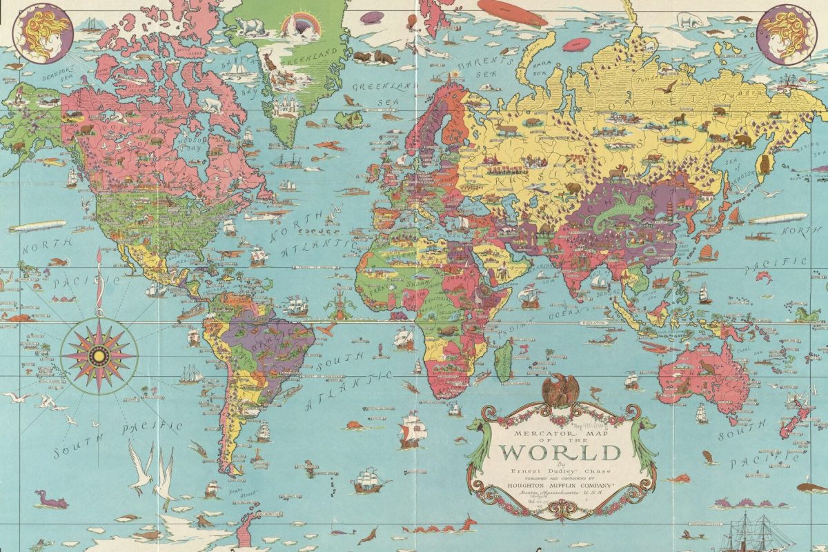
Cartography has long been central to how the United Nations positions itself on the global stage. This is evident in everything from the maps attached to Security Council documents, to the official emblem and flag of the UN, which famously depicts a map centred on the North Pole, surrounded by a pair of olive branches. For all the sense of cohesion evoked by these images, the way in which different parts of the world are depicted has nevertheless become a source of contestation among states. On 4 September 2026, by 164 votes to one, with six abstentions, the General Assembly adopted Resolution 80/307, titled “Correct the Map”, an initiative led by Togo and backed by the African Union. Advocating for the use of equal-area projections, the initiative sought to promote alternatives to the widely used 16th-century Mercator map and address unbalanced representations of Global South regions. There is, of course, more at stake in Resolution 80/307 than a dispute about relative scale; the initiative also raises questions about the role of map-making in sustaining particular conceptions of sovereign statehood.
What follows for international law from this development has already been the subject of two distinct accounts. Hendrik Mathis Drößler has examined the legal value of maps in territorial and boundary disputes, arguing that reforms to the UN’s cartographic practices must attend to both “continental proportions” and “the legal positions maps communicate”. Elsewhere, Luis Eslava has described Resolution 80/307 as a reminder that “international law can still be a site where deeply asymmetrical ways of organising the world are brought into view and contested”.
Building on these accounts, this post argues that the UN’s cartographic practices have helped constitute international legal space, translating relations of power into standardised forms that produce and reproduce a particular vision of international order. Understanding this dynamic is key to grasping the possibilities and limitations of Resolution 80/307, both in terms of how it seeks to address disparities in existing cartographic practices and in how it leaves the territorial divisions and political configurations through which certain regions are represented largely undisturbed.
To develop this argument, the post focuses on the UN’s cartography of decolonisation, showing how the transition from colonial dependency to sovereign statehood was rendered through, and helped consolidate, a world of territorially bounded states. It then returns to the “Correct the Map” initiative, asking what equal-area projections change within this spatial order, and what remains undisturbed. In doing so, the post situates itself within a wider literature that has questioned the treatment of maps as objective representations of a pre-existing reality. Cartography, in this sense, is viewed as a distinct mode of knowledge production, a practice tied to relations of colonial dominance, and an “inscriptive institution” that perpetuates a particular spatial understanding of how international authority is allocated and distributed.
Mapping Decolonisation
The decolonisation process, with its fluid political geographies and spatial imaginaries, provides useful insight into the constitutive power of the UN’s map-making practices. In the decades following the organization’s establishment, more than eighty former colonies achieved independence, with membership of the UN expanding from 51 states in 1945 to 127 by 1970. This period of enlargement coincided with a parallel growth in the organization’s cartographic records. UN Geospatial describes its early “general maps” as “profile maps” that sought to raise awareness of the location of member states, and in turn provide “recognition of [their] political independence and territorial integrity”. Its cartographic archive, in turn, documents this period through maps concerning both “decolonization” and “the creation of new States”, preserving in visual form the changing territorial configurations that accompanied the enlargement of the UN system.
A clear illustration of this spatial rendering of statehood can be found in the organization’s successive student maps of the world. Each map identified members of the UN by virtue of their territorial boundaries, recording their date of admission into the organization, geographic size, and population. As more former colonies joined the UN system, changes in their international legal status were accordingly registered as changes in how they were cartographically represented. Territories previously situated within the confines of colonial administration now appeared as independent states, separately named, bounded and enumerated alongside others. In this sense, the UN’s cartographic practices did more than provide an illustrated backdrop to decolonisation. As newly independent states formally entered the international legal order, successive maps rendered that transformation spatially, representing each state as a discrete unit within a wider conglomeration of states. Cartography thereby provided the principle of sovereign equality a spatial form, embodied in the image of the territorially bounded state, through which an expanding international order could be imagined and realised.
The distinctiveness of this spatiality lies in the ability of maps to confer an apparent geographical fixity upon historically contingent arrangements of political authority. As Thongchai Winichakul has shown in his study of ideas of nationhood in nineteenth-century Siam (the precursor to present-day Thailand), the introduction of modern cartography helped displace overlapping claims to sovereignty and indeterminate frontiers with a conception of political authority organised around demarcated territorial boundaries. Maps produced as part of surveying efforts by the Siamese authorities and European colonial powers provided a framework for the delimitation of sovereign authority, reconfiguring overlapping tributary sovereignties within the region into the spatial confines of a territorially bounded state. As these boundaries became further entrenched, subsequent atlases retrospectively depicted earlier kingdoms as similarly bounded political entities, lending this territorial form the illusion of historical continuity. Presented this way, territories could take on a visual identity detached from the historical and political processes that established their boundaries. Benedict Anderson captures a similar dynamic in his concept of the ‘map-as-logo’, in which colonies appeared as “a detachable piece of a jigsaw puzzle”, abstracted from their wider geographical context. By depicting former colonies according to the same cartographic conventions used to represent other members of the organization, the UN’s maps accordingly helped naturalise the territorially bounded state as the standard form of postcolonial independence, obscuring the political struggles and competing conceptions of statehood that defined the very process of decolonisation.
The territorial conception of statehood reproduced in these maps also found legal expression in the constitution of postcolonial borders. Through the application of the uti possidetis juris principle, cartographic materials became evidence from which the boundaries of newly independent states could be reconstructed. In Frontier Dispute (Burkina Faso/Republic of Mali), the International Court of Justice (ICJ) stated that the principle was “logically connected” with the process of gaining independence, ensuring respect for the territorial status quo and transforming old “administrative boundaries” into “international frontiers” (see paras 20-23). Nearly two decades later, the Court applied a similar rationale in Frontier Dispute (Benin/Niger), treating the date of independence as the point when colonial administrative boundaries became international borders, while acknowledging the relevance of maps as materials capable of establishing the territorial “situation” to which the uti possidetis rule applied (see paras 23-26).
This approach produced a tension within the spatial ordering of decolonisation. Even as the preservation of inherited boundaries protected newly independent states against territorial fragmentation and competing claims for sovereignty at the moment of independence, it also imposed territorial limits on the exercise of postcolonial statehood. Mohammad Shahabuddin presses the latter point further, arguing that the maintenance of colonial boundaries in the decolonial context entrenched territorial arrangements that sat uneasily with competing claims of self-determination. This particular framing of independence in terms of territorial statehood notably emerged amidst competing visions of post-colonial political organisation that extended beyond the confines of a single state (see, for example, Kwame Nkrumah’s proposals for “African Unity”, as well as contemporaneous debates surrounding a potential East African federation). The UN’s map-making practices, in turn, helped lend this emerging settlement an authoritative and reproducible institutional form, encoding both the possibilities opened by sovereign independence, and the constraints inherent within its particular vision of statehood. Indeed, as more former colonies joined the organization, they were progressively incorporated into a shared cartographic field whose representational conventions shaped the terms on which they became visible in relation to one another.
Correcting the Map?
Set against this history, it becomes clear that Resolution 80/307 carries implications that go far beyond the relative accuracy of competing projections of global space. Because the UN’s cartographic practices have helped constitute the spatial terms through which the international community is represented, reconsidering those terms affects both how that order is represented and the institutional patterns that sustain it. Such terms not only encompass the relative prominence accorded to different regions on maps, but also extend to the wider territorial arrangements that signify the allocation of sovereign authority. Three particular points are made to this end.
First, the “Correct the Map” initiative contests a representational hierarchy within existing depictions of the world. Equal-area projections do not alter the territorial status of states or their borders; rather, they alter the spatial relations in which those territories are depicted alongside each other. This is precisely the terrain on which the campaign proceeds. Introducing the Resolution, Togo’s Foreign Minister argued that correcting the map required reflection on how knowledge is “produced, transmitted and visualized”, and a “fair and faithful representation of the surface areas of the continents in world cartography”. Once maps are understood as constitutive practices that sustain a vision of international order, relative scale becomes one way in which the prominence and marginality of states are reproduced within that field. Equal-area projection, in turn, provides a particular avenue for contesting these dynamics, reallocating the cartographic space traditionally afforded to specific parts of the globe.
Second, although Resolution 80/307 seeks to redress inequalities in how particular states are cartographically represented, it does so without disturbing the structures in which the relations between them are organised. UN maps adopting Equal Earth projections may restore the relative scale of regions historically diminished on world maps, while still projecting a vision of international space as a mosaic of territorially discrete sovereign states. “Correcting” the map, in this sense, redistributes patterns of visibility within a particular mode of representing the international community, but does not seek to disrupt the spatial categories through which that vision of the world is constituted. While former colonies may consequently occupy a larger share of the world map, they remain tethered to the same inherited borders in which their claims to postcolonial statehood were realised. The initiative thus demonstrates both the possibilities and limitations of cartographic reform. While the proportions of world maps may change, their underlying conception and configurations of political space remain substantially intact.
Finally, the initiative opens up other UN map-making practices to greater scrutiny. The UN already standardises the names of geographical locations for international use, and its cartographic guidelines require maps issued by the Secretariat to undergo clearance to ensure consistency with existing UN policies. The Clear Map service further supplies a common cartographic base for use across the organization. Once we destabilise the assumption that these practices are nothing more than neutral, technical processes, the same question emerges: what vision of international order do they collectively presuppose and instantiate?
The map at the centre of the UN’s emblem may thus project an image of the international community as a unified whole. But the questions over how that world should now be drawn underscore the importance of unsettling what is too readily taken as a given regarding the territorial divisions and spatial hierarchies effected by and through the law.

Udit Mahalingam is a Supervisor in Law at the University of Cambridge and a Teaching Associate at the School of Law, Queen Mary University of London. He is particularly interested in questions of international law and global governance.